Maps
About our map collection
Our map collection consists of over 1,500 maps of all types, from 16th-century county maps to modern “Goad” maps of shopping centres. Most of them are original, but some are copies of maps held in other archives. Our map collection focuses on the Borough of Kingston upon Thames, but neighbouring areas may also appear on larger maps. Many of our archive collections include maps that are listed separately from the main map collection.
Early Maps
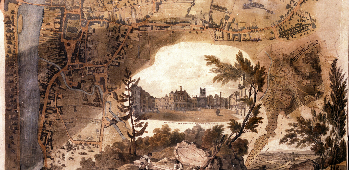
Early maps usually show the whole county rather than specific places. Maps from the 16th and 17th centuries show little more than the location of places. In the 18th century maps became more detailed; John Rocque's map from 1762 is a good example of this. Greenwood's map from 1823 is also very detailed. We hold copies of most early maps of the area.
Ordnance Survey Maps
Ordnance Survey maps were developed to provide the military with detailed maps of the country after the Jacobite rebellion of 1745 and the Napoleonic wars of the 1790s. The first edition, published in 1811, provides little detail at one inch to the mile. In the 1860s, more detailed maps were published at 6 inches to the mile and 25 inches to the mile. These were revised every 20–30 years. We hold copies of these maps for the whole borough, from the first edition to more recent editions.
Enclosure and tithe maps
Medieval agriculture was based around open fields, but by the end of the 18th century most of the land around Kingston had been enclosed by private agreement. Only the commons and open land remained, and these were also enclosed by Act of Parliament in 1808. Tolworth was enclosed in 1818. The original maps are held at the Surrey History Centre, but we have copies.
Tithes were paid by landowners to the church as a tax, originally on one tenth of owners possessions. The liability to pay tithes was normally removed in a parliamentary enclosure act, but if land had already been privately enclosed a separate agreement was needed under the Tithe Commutation Act 1836. We have a copy of the tithe map for Kingston from 1840 (the original is at Surrey History Centre).
Both enclosure and tithe maps show property boundaries and owners.
Estate Plans
Estate plans were used by property owners or included in a property’s sales details. We have copies of estate plans from the mid-18th century, including a plan of Claremont House and Park (1750), and many plans from the mid-19th to the mid-20th centuries, showing how properties were sold to building firms as the area became developed.
Special Maps
Special maps were drawn up for all sorts of reasons. They were often based on Ordnance Survey maps but with extra information. We have maps and plans showing the location of bombs in Kingston and Surbiton (1939–1945), street plans, engineers’ plans for the 1980s, local development and local government plans, geology plans, and “Goad” plans of local shopping centres, showing all the shops and commercial premises in a town centre. The “Goad'' plans cover Chessington (Hook Road) from 1991, Kingston town centre from 1968, New Malden High Street from 1973, Surbiton (Victoria Road) from 1972, and Tolworth Broadway from 1993. We also have maps which show local government ward boundaries, footpaths and water supply.
Fees and charges
View the service fees and charges including reproductions and filming.
Research services
View our research services and fees.